


Montezuma Pass to the Mexican Border
52 Hikes in 2025 - Hike #2

In addition to being the 2nd hike for our 52 hikes in 2025 challenge, this was also the first small segment on passage 1 of the Arizona trail.

On our way out to the trailhead, we stopped at the Coronado National Memorial visitors center to pick up another copy of Leonard Taylor’s Trails of the Huachucas book. I lent my copy to a coworker and never got it back when he moved. Since we intend to do a lot more hiking in our mountains this year, this book will live in my backpack and likely be referred to quite frequently.
Up, Up, Up the Winding Dirt Road
There is a nice parking lot at Montezuma Pass, but to get there you have to go up a slightly steep in places, switch-backing dirt/gravel road. There are few bumps in spots, but it’s entirely doable in a car. You do have to take it slow, and watch out for people in ATVs or motorcycles coming fast around the turns on their way up or down the mountain. Once you reach the parking lot, there are clean restrooms, maps and history graphics, and even a visitor's book that you can sign.
Joe’s Canyon Trail
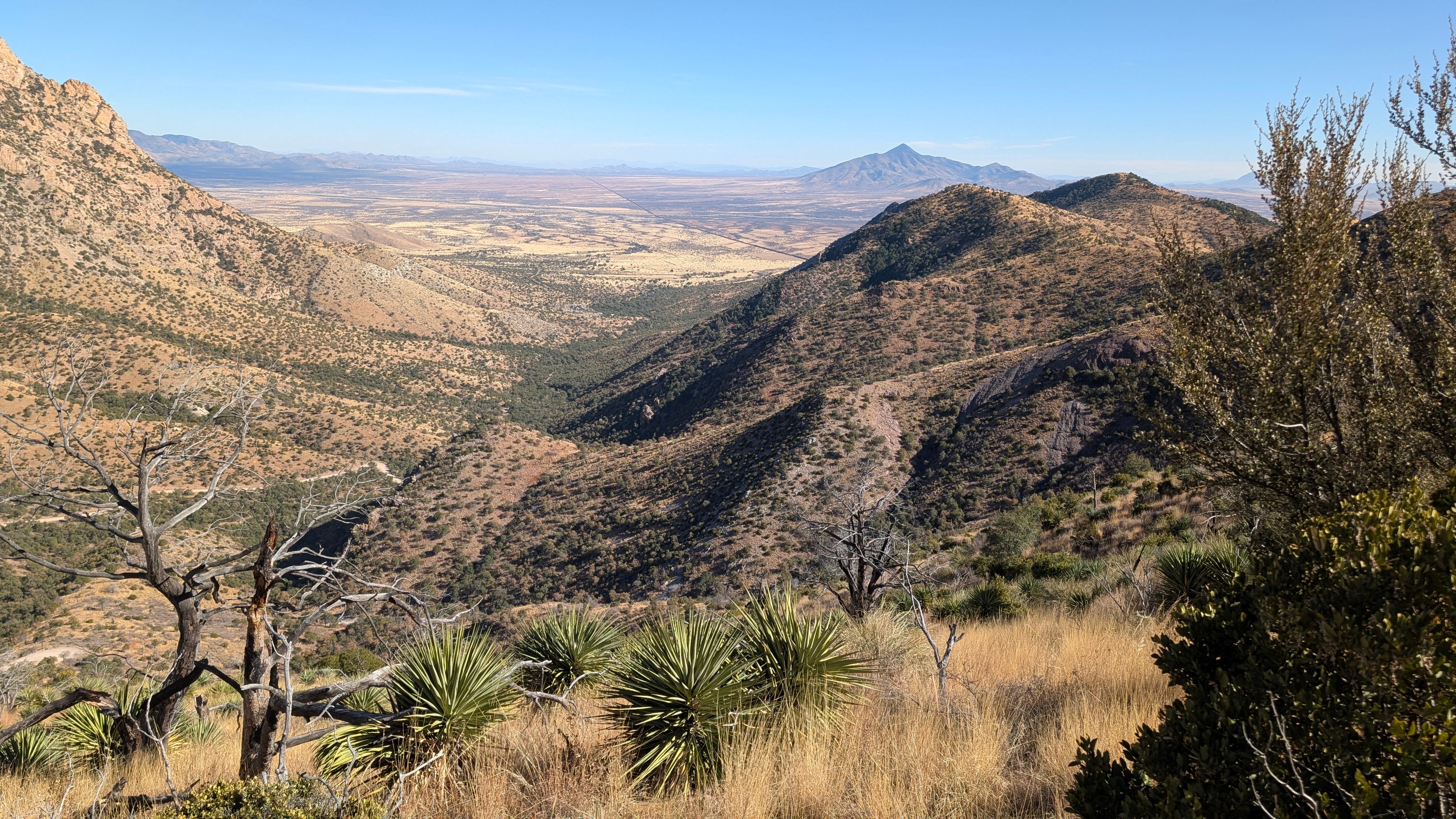
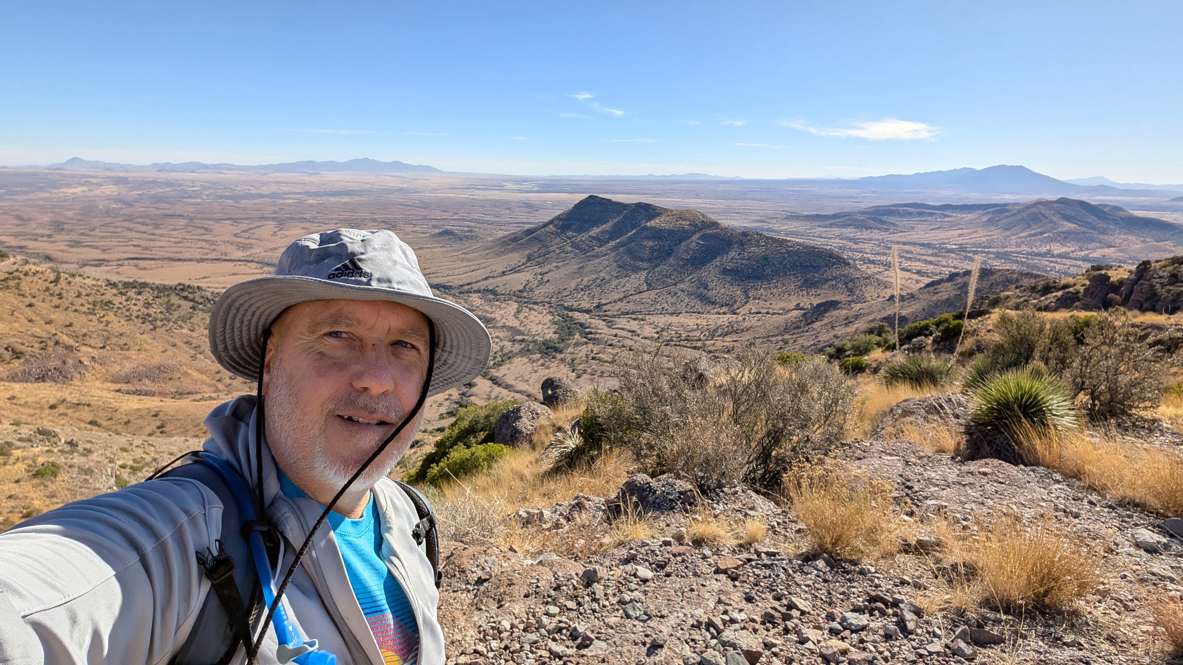
Just off the parking lot, near the restrooms, there is trailhead that leads to Coronado Peak. About 100 yards or so up that trail, you will veer off to the left on Joe’s Canyon Trail. This is a narrow little trail along the side of the mountain, but the views are spectacular.
Yaqui Trail
About a mile down Joe’s Canyon Trail, you’ll come to a fork. If you continue straight, you can hike another 3 1/2 miles or so back down to the visitor’s center (note: we saw a sign that Thus-Sat at 8:30 am, there is a shuttle that will take you from the visitor’s center up to Montezuma Pass, then you can hike back down to your car). But we wanted to go to the right, taking Yaqui Trail down to the Mexican border, and the southern terminus of the 800 mile Arizona National Scenic Trail.
This one-mile section of the trail, was steeper, with a few switchbacks on our way down. But we were again treated to some very nice views of the Sonoran Plateau in Mexico.
We were a little bit confused (although it was our own fault) when we reached the bottom of the trail, as there is no signage indicating anything about this being the start of the Arizona Trail. Instead, you simply walk over to International Boundary Marker 102 and take a selfie through the barbed wire.
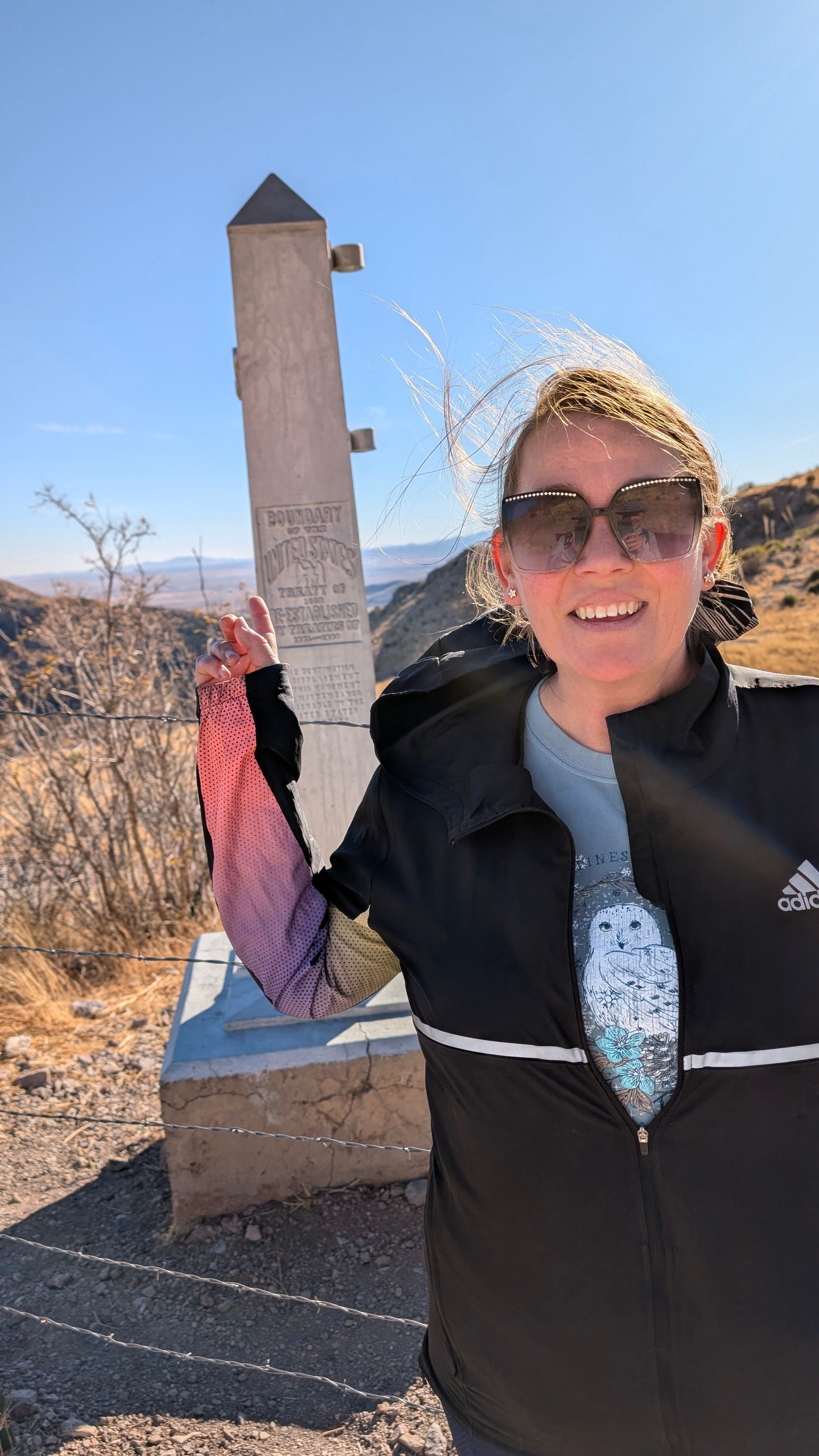
It was very windy on Saturday the 4th of January when we did this hike. That didn’t stop Kelly from making sure she didn’t miss anything, so shortly after the picture, she took off down the dirt road that runs along the U.S. side of the border. I myself took the opportunity to sit down and rest for a few minutes. But it wasn’t without entertainment as a tumbleweed rolled by.
Back Up We Go
The start of the hike back up Yaqui trail was pretty steep and a little demoralizing at first. Fortunately, it’s only about a mile long, then when you reach the junction with Joe’s Canyon trail, there a nice little flat section of the trail on which to recover. Seriously, as far as uphill hikes go, this was not bad at all. I felt a little guilty for complaining. Lol, and if we had been continuing Passage 1 of the Arizona Trail, we would have still had several miles of steep uphill climbs ahead of us. But that will be saved for another day.
We were done before sunset, and only had a 20 minute drive back home. All-in-all it was a fairly productive use of a Saturday afternoon in January.

Til next time,
Todd